Explore entries from James Cook’s Endeavour journal for May 1770, as the ship sailed from Botany Bay to Cape Palmerston in present day Queensland.


Images and transcripts kindly supplied by the National Library of Australia.
Transcripts
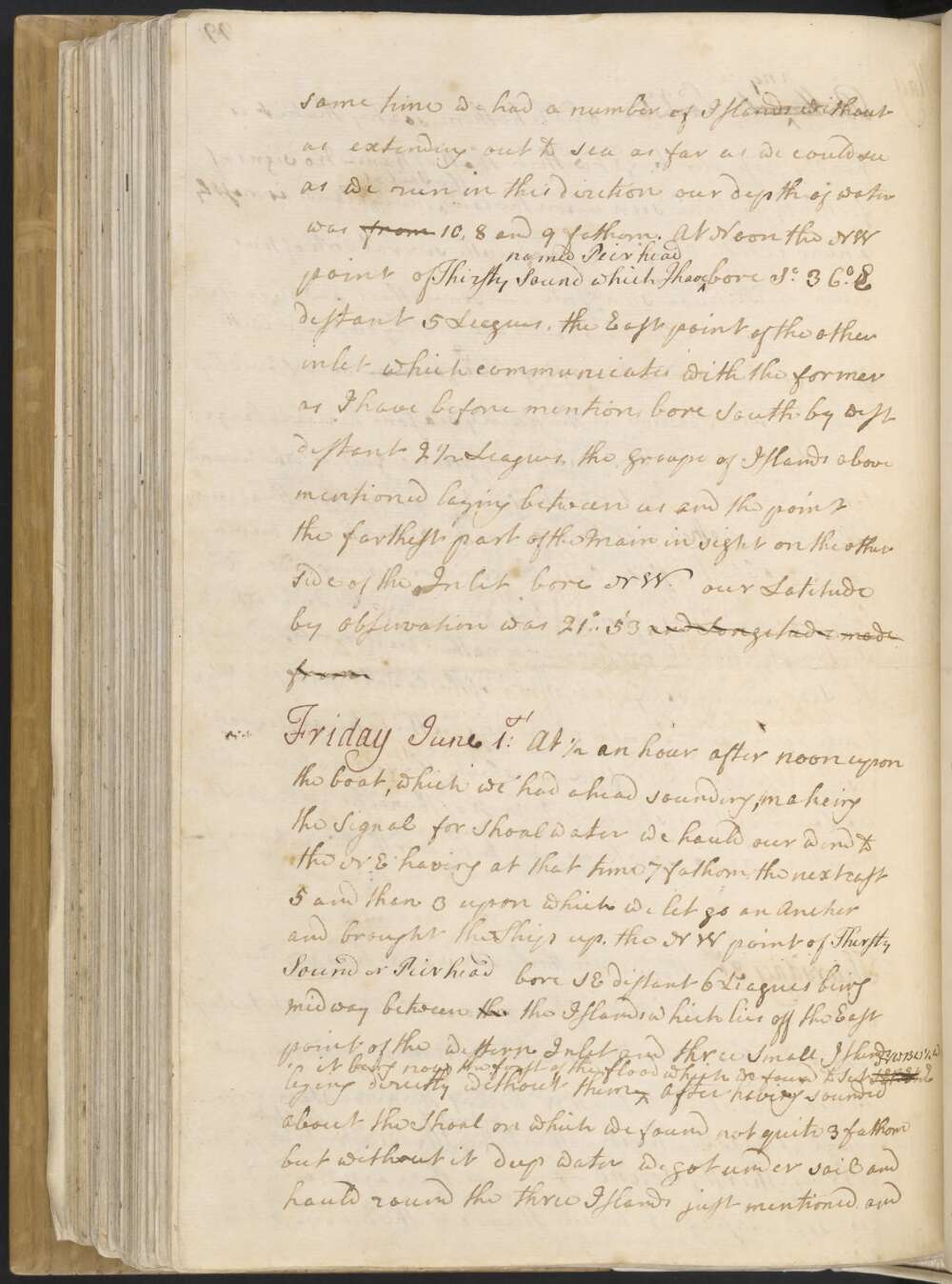
Thursday, 31st. Winds southerly and SE dark hazey weather with rain in the PM. finding no one inducement to stay longer in this place we at 6 in the AM weighd and put to Sea and stood to the NW having the advantage of a fresh breeze at SSE. We kept without the Group of Islands which lay in shore & to the NW of Thirsty Sound, as there appear'd to be no safe passage between them and the Main; at the same time we had a number of Islands without us extending out to sea as far as we could see. As we run in this diretion our depth of water was 10, 8 and 9 fathom.
At Noon the NW point of Thirsty Sound which I have named Pier head bore S 36° E distant 5 Leagues, the East point of the other inlet, which communicates with the former as I have before mention, bore South by west distant 2½ Leagues, the groupe of Islands above mentioned laying between us and the point; the farthest part of the Main in sight on the other side of the Inlet bore NW. Our Latitude by Observation was 21° 53'.
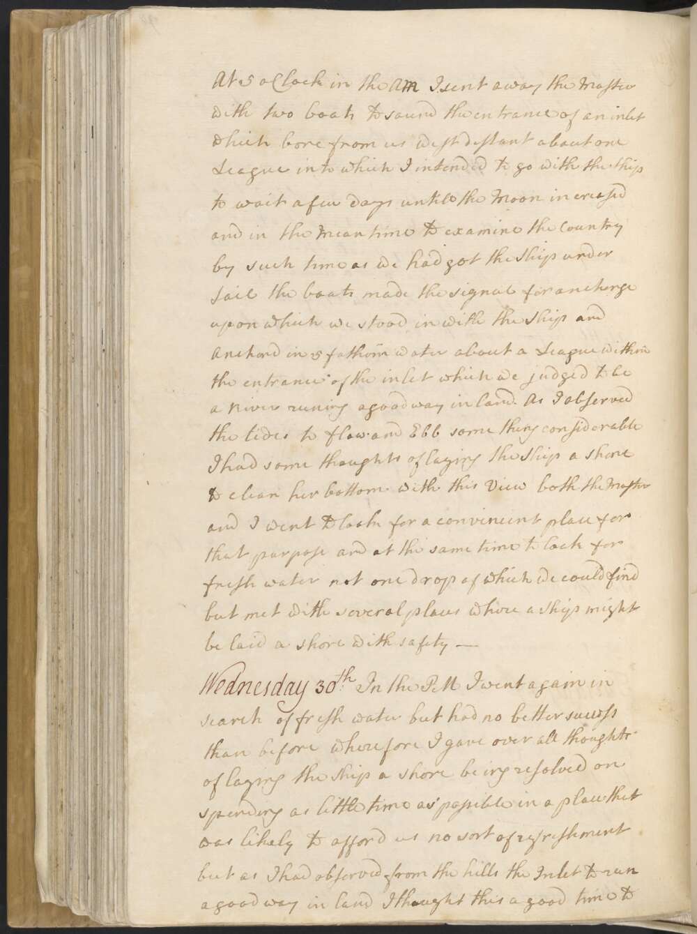
Wednesday 30th In the PM I went again in search of fresh water but had no better success than before wherefore I gave over all thoughts of laying the Ship a shore being resolved on spending as little time as possible in a place that was likely to afford us no sort of refreshment but as I had observed from the hills the Inlet to run a good way in land I thought this a good time to penetrate into the Country to see a little of the inland parts
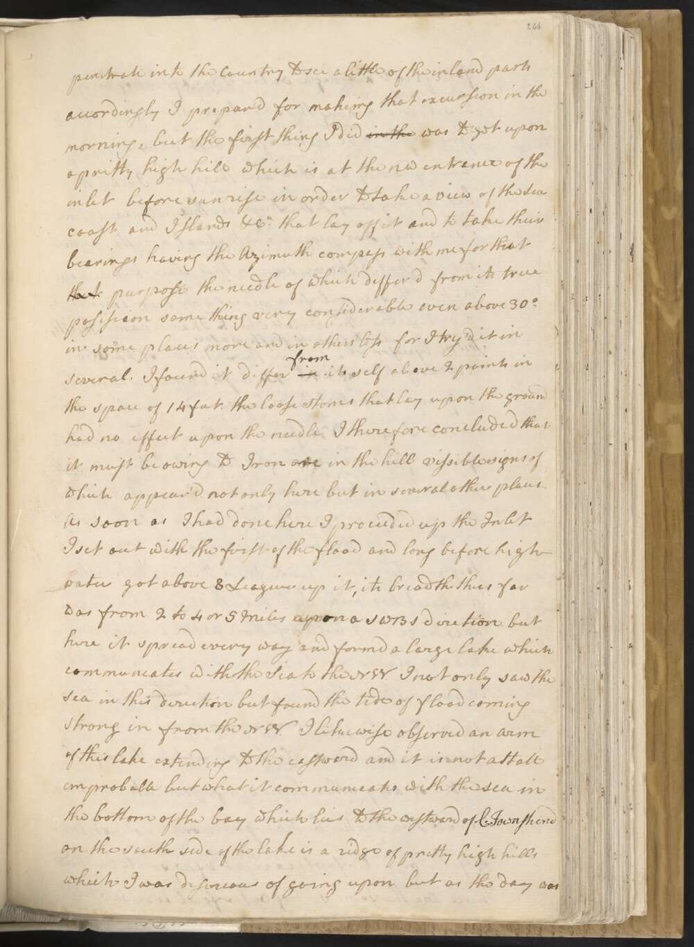
Accordingly I prepar'd for makeing that excursion in the morning, but the first thing I did in the was to get upon a pritty high hill which is at the NW entrance of the inlet before sunrise in order to take a view of the Sea coast and Islands &Ca that lay off it and to take their bearings, having the Azimuth compass with me for that that purpose the needle of which differd from its true posission some thing very considerable even above 30° in some places more and in others less for I try'd it in several. I found it differ in from it self above 2 points in the space of 14 feet, the loose stones which lay upon the ground had no effect upon the needle I therefore concluded that it must be owing to Iron ore in the hill visible signs of which appear'd not only here but in several other places —
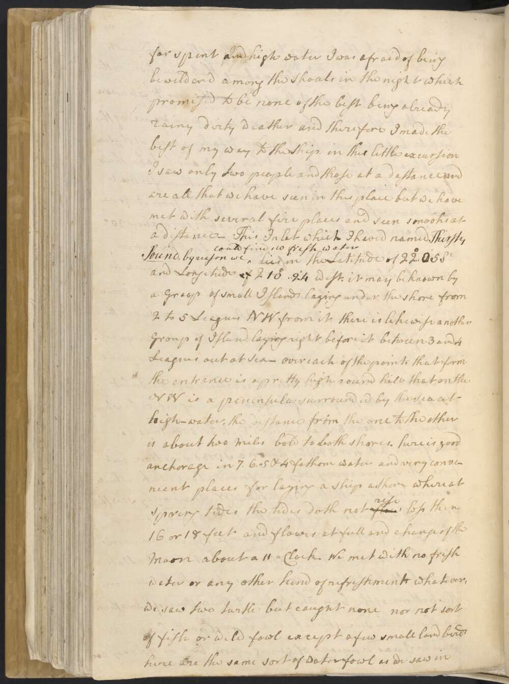
As soon as I had done here I proceeded up the Inlet I set out with the first of the flood and long before high-water got about 8 Leagues up it, its breadth thus far was from 2 to 4 or 5 Miles upon a SWBS diretion, but here it spread every way and formd a large lake which communcates with the Sea to the NW. I not only saw the Sea in this direction but found the tide of flood coming Strong in from the NW. I likewise observed an arm of this lake extending to the eastward and it is not att all improbable but what it communicates with the sea in the bottom of the bay which lies to the westward of C. Townshend on the south side of the lake is a ridge of pretty high hills which I was desireous of going upon, but as the day was far spent and high-water I was afraid of being bewilderd among the Shoals in the night, which promised to be none of the best being already rainy dirty weather, and therefore I made the best of my way to the Ship. in this little excursion I saw only two people and those at a distance and are all that we have seen in this place but we have met with several fire places and seen smooks at a distance —
This inlet which I have named Thirsty Sound by reason we could find no fresh water lies in the Latitude of 22°..05' S and Longitude 210°..24' West. It may be known by a Group of small Islands laying under the shore from 2 to 5 Leagues NW from it. there is likewise a nother Group of Islands laying right before it between 3 and 4 Leagues out at Sea — over each of the points that form the entrance is a pretty high round hill that on the NW is a peninsula surrounded by the Sea at high-water, the distance from the one to the other is about two Miles bold to both shores. Here is good anchorage in 7, 6, 5, & 4 fathom water and very convenient places for laying a Ship a Shore where at Spring tides the tides doth not flow rise less then 16 or 18 feet and flowes at full and change of the Moon about 11 oClock.
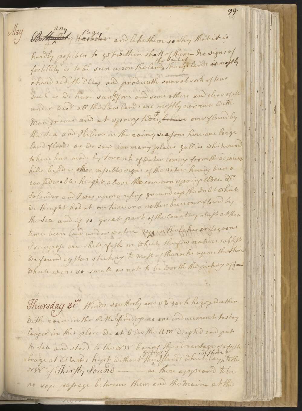
We met with no fresh water or any other kind of refreshments whatever, we saw two turtle but caught none nor not sort of fish or wild fowl except a few small land birds here are the same sort of water fowl as we saw in BotSting Ray any Harbour Bay and like them so Shy that it is hardly possible to get within shott of them — No signs of fertillity is to be seen upon the land the Soil of the uplands is mostly a hard redish Clay and produceth several sorts of trees such as we have seen before and some others and clear of all under woodall the low lands are mostly over run with Man groves and at spring tides beleive over flowed by the Sea, and I beleive in the rainy seasons here are large land floods as we saw in many places gullies which seem'd to have been made by torrents of water coming from the adjacent hills besides other vissible signs of the water having been a considerable height above the common spring tides —
Dr Solander and I was upon a rising ground up the Inlet which we thought had at one time or a nother been over flowed by the Sea and if so great part of the Country must at that time been laid under water — Up in the lakes or Lagoons I suppose are shell fish on which the few natives subsist We found oysters sticking to most of the rocks upon the Shore which were so small as not to be worth the picking off —
Tuesday 29th Fresh gales between the SSE and ESE, Hazey wer. with some showers of rain in the PM. Having sounded about the Ship and found that there was sufficient water for her over the Shoal we at 3 oClock weigh'd and came to sail and stood to the westward as the land lay having first sent a boat a head to sound — At 6 o'Clock we Anchord in 10 fathom a sandy bottom about 2 Miles from the Main land, the westermost part of which bore WNW having still a number of Islands in sight a long way without us —
At 5 oClock in the AM I sent away the Master with two boats to sound the entrance of an inlet which bore from us west distant about one League into which I intended to go with the Ship to wait a few days untill the Moon increased and in the meantime to examine the Country by such time as we had got the Ship under Sail the boats made the signal for Anchorge upon which we stood in with the Ship and Anchord in 5 fathom water about a League within the entrance of the inlet which we judged to be a River runing a good way in land. As I observed the tides to flow and Ebb something considerable I had some thoughts of laying the Ship a shore to clean her bottom. with this View both the Master and I went to look for a convinient place for that purpose and at the same time to look for fresh water not one drop of which we could find but met with several places where a Ship might be laid a shore with safety —
Monday 28th Winds at SSE afresh breezes At 3 oClock in the PM we pass'd Cape Manifold from which the Land trends NNW, the land of this Cape is tolerable high and riseth in hills directly from the Sea. it may be known by three Islands laying off it, one near the shore and the other two 8 Miles out at sea the one of these is low and flat and the other high and round —
At 6 oClock we shortend sail and brought too, the northermost part of the Main we had in sight bore NW and some Islands laying off it bore N. 31° west — our soundings sence noon were from 20 to 25 fathoms and in the night 30 and 34 fathom — At day light in the Morning we made sail Cape Manifold bearing SBE distant 8 Leagues and the Islands set last night in the same direction distant from us 4 Miles, and the farthest point of the Main bore N 67° Wt distant 22 Miles but we could see several Islands to the northward of this direction.
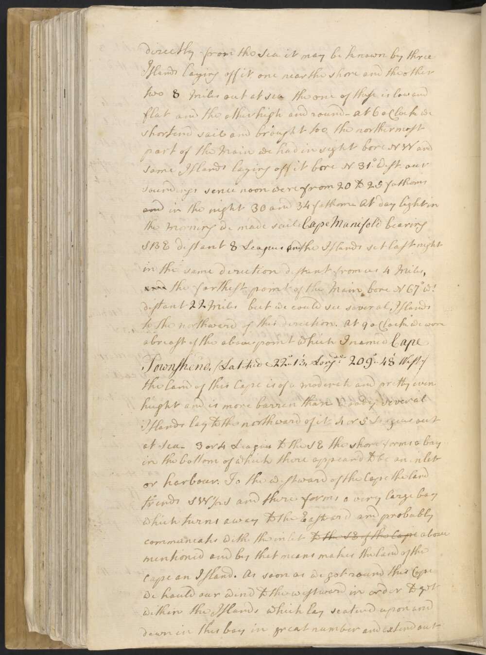
At 9 oClock we were abreast of the above point which I named Cape Townshend / Latitude 22°..13', Longde 209°..48' West / the land of this Cape is of a moderate and pretty even height and is more barren than woody. Several Islands lay to the northward of it 4 or 5 Leagues out at Sea — 3 or 4 Leagues to the SE the shore forms a bay in the bottom of which there appear'd to be an inlet or harbour.
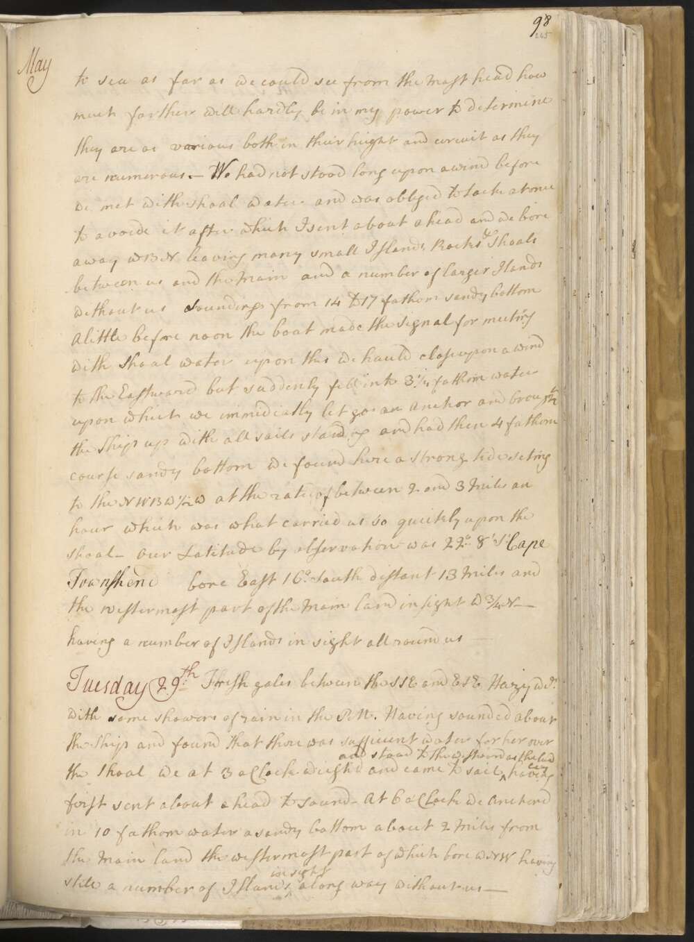
To the westward of the Cape the land trends SW½S and there forms a very large bay which turns away to the Eastward and probably comun[i]cates with the inlet to the SE of the Cape above mentioned and by that means makes the land of the Cape an Island. As soon as we got round this Cape we hauld our wind to the westward in order to get within the Islands which lay scaterd upon and down in this bay in great number and extend out to sea as far as we could see from the Mast-head how much farther will hardly be in my power to determine they are as various both in their height and circuit as they are numerous.—
We had not stood long upon awind before we met with shoal water and was obliged to tack at once to avoide it, after which I sent aboat ahead and we bore away WBN leaving many small Islands, Rocks Shoals between us and the Main and a number of larger Islands without us a Soundings from 14 to 17 fathom sandy bottom A little before noon the boat made the Signal for meeting with Shoal water upon this we hauld close upon a wind to the Eastward but suddenly fell into 3¼ fathom water — upon which we immidiatly let go an Anchor and brought the Ship up with all sails standing and had then 4 fathom course sandy bottom we found here a Strong tide seting to the NWBW½W at the rate of between 2 and 3 Miles an hour which was what carried us so quickly upon the Shoal — Our Latitude by observation was 22°..8' So Cape Townshend bore East 16° South distant 13 Miles and the westermost part of the Main land in sight W¾N — having a number of Islands in sight all round us —
Sunday 27th We had not stood on to the northward quite an hour before we fell into 3 fathom water upon which I anchor'd and sent away the Master with two boats to sound the Channell which lay to leeward of us between the Northermost Island and the Mainland which appeard to me to be pretty broad but I susspected that it was shoald and so it was found for the Master reported to me the upon his return that he found in many places only 2½ fathoms and where we lay at Anchor we had only 16 feet which was not 2 feet more then the Ship draw'd.
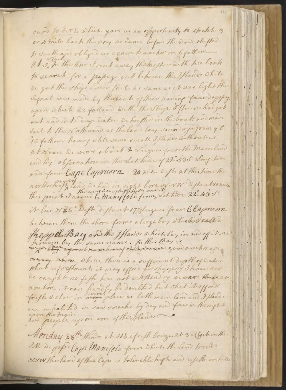
In the evening the wind veer'd to ENE which gave us an oppertunity to stretch 3 or 4 miles back the way we came before the wind shifted to South and oblige'd us again to anchor in 6 fathom —
At 5 oClock in the AM I sent away the Master with two boats to search for a passage out between the Islands while we got the Ship under sail. As soon as it was light the Signal was made by the boats of thier having found a passage upon which we followd with the Ship, After we had got out and into deep water we hoisted in the boats and made Sail to the Northward as the land lay, soundings from 9 to 15 fathom, having still some small Islands without us
At Noon we were about 2 Leagues from the Mainland and by observation in the Latitude of 22°..53' So Longitude made from Cape Capricorn 20 Miles west, At this time the northermost point of land we had in sight bore NNW distant 10 Miles this point I named C. Manyfold from the number of high hills over it Latitude 22°..43' So it lies N 26° West distant 17⅓ Leagues from C. Capricorn between them the shore forms a large bay which I call'd Keppel Bay and the Islands which lay in and off it are in known by the same name. In this Bay is it Lay are a great number of Islands and good anchorage every where where there is a sufficient depth of water What refreshments it may afford for shipping I know not we caught no fish here not withstanding we was were the le at anchor — It can hardly be doubted but what it affords fresh water in more several place as both main land and Islands are inhabited, we saw smooks by day and fires in the night upon the Main and people upon one of the Islands —
Saturday 26th In the PM had a light breeze at ESE untill 4 oClock with which we stood to the NW untill 4 o'Clock when it fell calm and soon after we Anchor'd in 12 fathom water Cape Capricorn bearing So 54° East distant 4 Leagues having the Main land and Islands in a manner allround us — in the night we found the tide to rise and fall near 7 feet and the flood to set to the west ward and Ebb to the Eastward, which is the very reverse to what we found it when at Anchor to the Eastward of Bustard Bay I expected
At 6 in the AM we weigh'd with the wind at South a gentle breeze and stood away to the NW between the outermost raing of Islands and the Main land, leaving several small Island between us and the latter which we passd close by — our soundings was a little erregular from 12 to 4 fathom which caused me to send a boat a head to sound. At Noon we were about 3 Miles from the Main, about the same distance from the Islands without us, our Latitude by obsn was 23°.7' So and Longitude made from Cape Capricorn 18 Miles west — The Main land in this Latitude is tolerable high and Mountainious and the Islands which lay off it are the most of them pretty high and of a small circuit and have more the appearence of barrenness than fertillity —
We saw smooks a good way inland which makes me think there must be a River Lagoon or Inlet into the Country and we pass'd two places that had the appearence of such this morning, but our depth of water at that time was too little to haul in for them where I might expect to meet with less —
Friday 25th In the PM had it calm untill 5 oClock when a light breeze sprung up at SE and we steer'd NW as the land lay untill 10 oClock then brought too having had all along 14 and 15 fathom water. At 5 in the AM we made sail, at day light the northermost point of the Main bore N 70° West and soon after we saw more land making like Islands bearing NWBN.
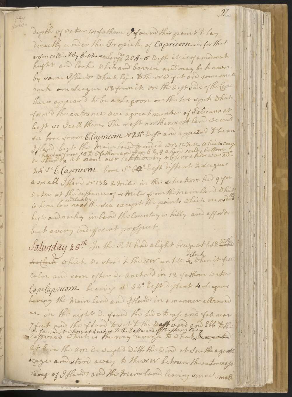
At 9 oClock we was were abreast of the point distant from it 1 Mile depth of water 14 fathom. I found this point to lay directly under the Tropick of Capricorn and for that reason call'd it by that Name Longde 209°..0' West it is of a moderate height and looks white and barren and may be known by some Islands which layes to the NW of it and some small rocks one League SE from it. On the west side of the Cape there appear'd to be a Lagoon, on the two spits which form'd the entrance were a great number of Pelicans at least so I call them. The most northermost land we could see bore from C. Capricorn N. 24° West and appear'd to be an Island, but the Main land trended WBN½N which Course we steer'd — having from 15 to 6 fathom and from 6 to 9 a hard sandy bottom
At noon our Latitude by observation was 23°..24' So C. Capricorn bore So 60°— East distant 2 Leagues a small Island NBE 2 Miles. in this situation had 9 fm water at the distance of 4 Miles from the Main land which is here low and Sandy next the Sea except the points which are moderatly high and rocky in land the Country is hilly and affords but a very indifferent prospect
Thursday 24th In the PM I was empd a Shore in the transactions before related. At 4 in the AM we weighd with a gentle breezes and South and made sail out of the Bay which I call'd the north point of which I call'd and the South point the distance from the one to the other is NW½N and SE½S Miles. In standing out of the Bay our soundings were from 5 to 15 fm when in this last depth we was were abreast of the north point and being day light we discoverd breakers stretching out from it about NNE 2 or 3 Miles at the outermost part of them is was a rock just above water.
in passing these rocks at the distance of half a Mile we had from 15 to 20 fathom, being past them we hauld away long shore WNW for the far farthest land we had in sight. At Noon we were by observation in the Latitude of 23°..52' So the north pt of Bustard Bay bore So 62° East distant 10 Leagues Miles and the northermost land in sight N. 60° Wt Longde in 208°..37' Wt distant from the nearest shore 6 Miles in this situation had 14 fathom water —
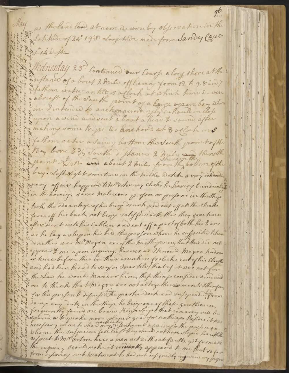
Wednesday 23rd Continued our Course a long shore at the distance of about 2 Miles off having from 12 to 9, 8 and 7 fathom water untill. 5 oClock at which time we were abreast of the South point of a large open bay where in I intended to anchor. accordingly we hauld in close upon a wind and sent a boat a head to sound. after making some trips we anchor'd at 8 oClock in 5 fathom water a Sandy bottom the South point of the Bay bore E¾ South distance 2 Miles and the north point NW¼N and about 2 Miles from the shore in the bottom of the bay.
Last night some time in the Middle Watch a very extraordinary affair happend to Mr Orton my Clerk, he having been drinking in the Evening, some Malicious person or persons in the Ship took the advantage of his being drunk and cut off all the cloaths from off his back, not being satisfied with this they some time after went into his Cabbin and cut off a part of both his Ears as he lay asleep in his bed, the person whome he suspected to have done this was Mr Magra one of the Midshipmen, but this did not appear to me upon inquirey, however as I know'd Magra had once or twice before this in their drunken frolicks cut off his Cloaths and had been heard to say / as I was told / that if it was not for the Law he would Murder him, these things consider'd induce'd me to think that Magra was not altogether innocent, I therefore, for the present dismiss'd him the quarter deck and susspended him from doing any duty in the Ship, he being one of those gentlemen, frequently found on board Kings Ships, that can very well be spared, or to speake more planer good for nothing. Besides it was necessary in me to show my immedate resentment againest the person on whome the suspicion fell least they should not have stop'd here.
With respect to Mr Orton he is a man not without faults, yet from all the enquiry I could make, it evidently appear'd to me that so far from deserving such treatment he had not designedly injured any person in the Ship, so that I do and shall all ways look upon him as an enjure'd man. Some reasons might however be given why this misfortune came upon him in which he himself was in some measure to blame, but as this is only conjector and would tend to fix it up some people in the Ship whome I would fain believe would hardly be guilty of such an acton, I shall say nothing about it unless I shall hereafter discover the Offenders which I shall take every method in my power to do, for I look upon such proceedings as highly dangerous in such Voyages as this and the greatest insult that could be offer'd to my authority in this Ship, as I have always been ready to hear and redress every complaint that have been made against any Person in the Ship.
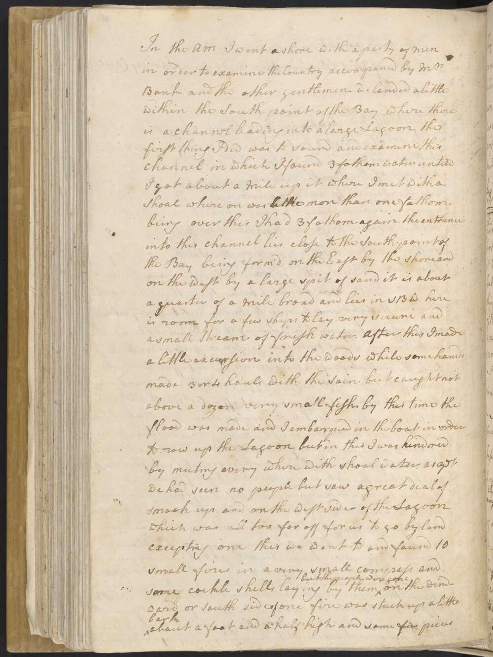
In the AM I went a shore with a party of men in order to examine the Country accompaned by Mr Banks and the other gentlemen. we landed alittle within the South point of the Bay where there is a channel leading into a large Lagoon, the first thing that I did was to sound and examine this channel in which I found 3 fathom water untill I got about a Mile up it where I met with a Shoal whereon was little more than one fathom being over this I had 3 fathom again. the entrance into this channel lies close to the South point of the Bay being form'd on the East by the shore and on the West by a large spit of sand it is about a quarter of a Mile broad and lies in SBW here is room for a few Ships to lay very secure and a small Stream of fresh water.
After this I made a little excursion into the woods while some hands made 3 or 4 hauls with the Sain but caught not above a dozen very small fish, by this time the flood was made, and I embarqued in the boat in order to row up the Lagoon but in this I was hindred by meeting every where with shoal water, as yet we had seen no people but saw a great deal of smook up and on the west side of the Lagoon which was all too far off for us to go by land excepting one this we went to and found 10 small fires in a very small compass and some cockle shells laying by them but the people were gone
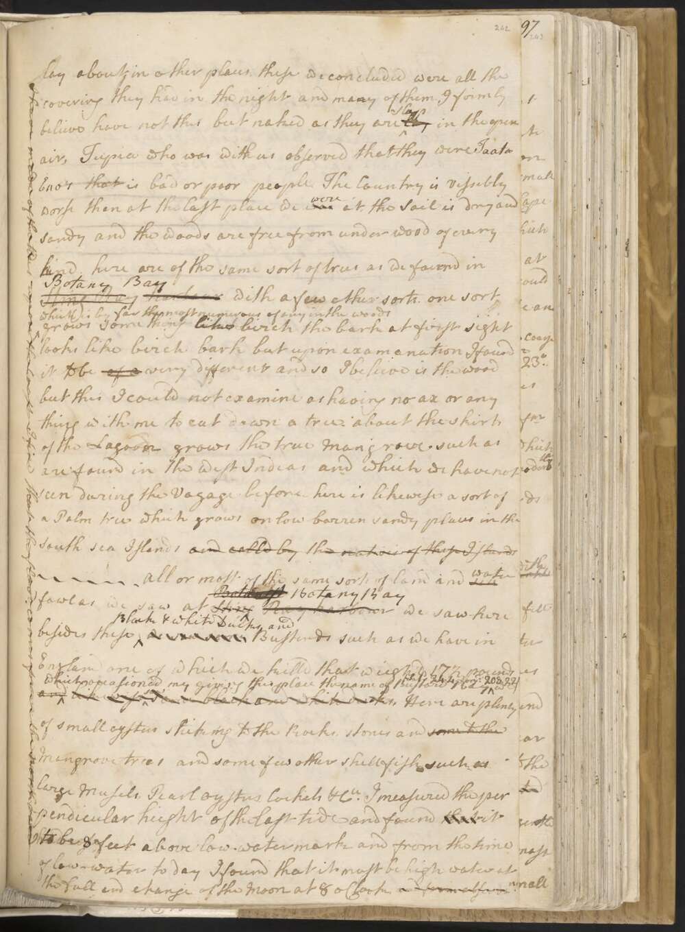
On the windward or South Side of one fire was stuck up a littl bark about a foot and a half high and some few peices lay about in other places, these we concluded were all the covering they had in the night and many of them I firmly believe have not this but naked as they are Sleep lay in the open air, Tupia who was with us observed that they were Taata Eno's that is bad or poor people. The Country is vissibly worse than at the last place we was were at, the Soil is dry and Sandy and the woods are free from under wood of every kind. here are of the same sort of trees as we found in Sting Ray Harbour Botany Bay with a few other sorts.
one sort which is by far the most numerous of any in the woods grow something like birch the bark at first sight looks like birch bark but upon examination I found it to be of a very different and so I believe is the wood but this I could not examine as having no ax or any thing with me to cut down a tree — about the skirts of the Lagoon grows the true Mangrove such as are found in the West Indias and which we have not seen during the Voyage before — here is likewise a sort of a Palm tree which grows on low barren and sandy places in the South Sea Islands and calld by the natives of these Islands — All or most of the same sorts of land and sea water fowl as we saw at Sting Botanist Botany Bay Ray harbour we saw here besides these Black White Ducks, and we saw some Bustards such as we have in England one of which we kill'd that weigh'd 17 ½ pounds and which occasioned my giving this place the name of Bustard Bay /Latd 24.4. Longd 208.22/ likewise saw some black and white ducks,
Here are plenty of small oysters sticking to the Rocks, stones and some to the Mangrove trees and some few other shell fish such as large Musels, Pearl oysters, Cockels &Ca I measured the perpendicular height of the last tide and found that it to be 8 foot above low-water mark and from the time of low-water to day I found that it must be high water at the full and change of the Moon at 8 oClock, and from observn I have made of the tides upon the Coast I find that the flood comes from the northward —
Tuesday 22nd In the PM had a gentle breeze at SE with which we stood in for the land SW untill 4 oClock when being in the Latde of 24°. 36' So and about 2 Leagues from land in 9 fathom water we bore away along shore NWBW
At the same time we could see the land extending to the South South East about 8 Leagues. Near the Sea the land is very low but in land are some moderatly high hills and the whole appear'd to be thickly cloathed with wood
In runing along shore we shoald in our water from 9 to 7 fathom and at one time had but 6 fathm which determined me to anchor for the night and accordingly at 8 oClock we came too in 8 fathom water a fine gravely bottom about 5 Miles from the land. this evening we saw a water snake and 2 or 3 evenings ago one lay under the Ships stern some time this was about a yard and a half in length and was the first we had seen —
At 6 oClock in the AM we wieg'd with a gentle breeze southerly and steerd NW¼W edgeing in for the land untill w[e] got within 2 Miles of it having from 7 to 11 fathom water, we then steer'd NNW as the land laid, At Noon we were by observation in the Latitude of 24°.19' So Longitude made from Sandy Cape 1°..14' West —
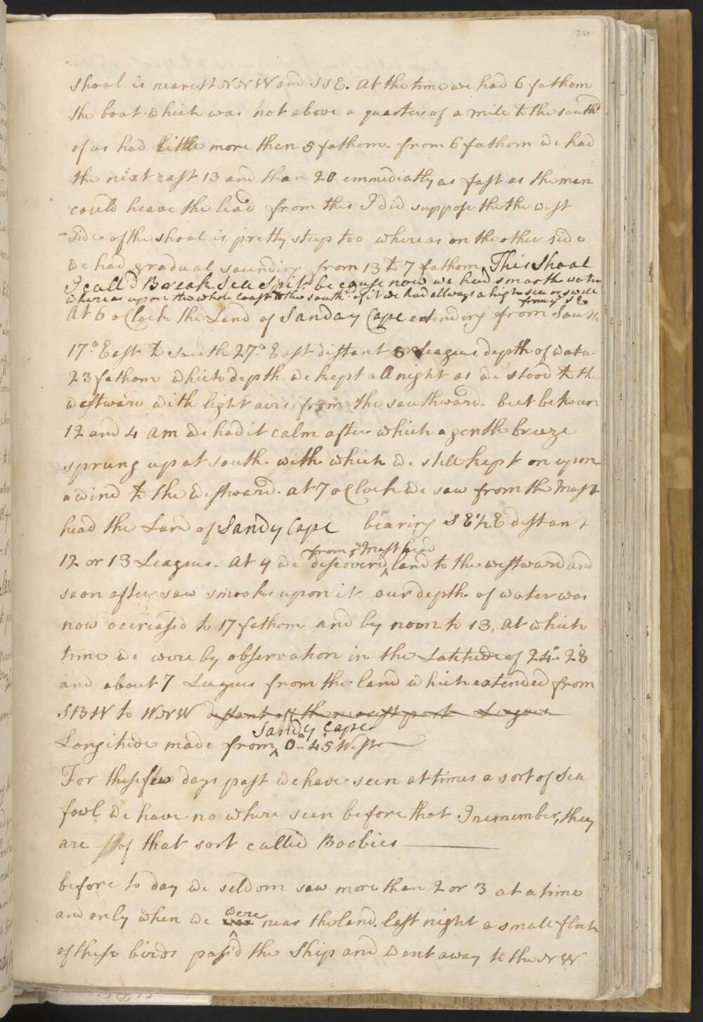
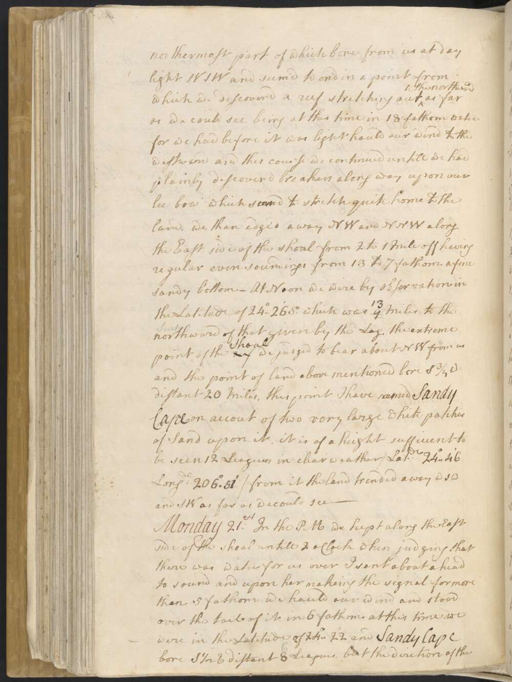
Monday 21st. In the PM we kept along the East side of the shoal untill 2 oClock when judging that there was water for us over I sent a boat a head to sound and upon her making the signal for more than 5 fathoms we hauld our wind and stood over the tail of it in 6 fathom. at this time we were in the Latitude of 24°..22' and Sandy Cape bore S½E distant 8 Leagues. but the diretion of the Shoal is neares NNW and SSE.
At the time we had 6 fathom the boat which was not above a quarter of a mile to the southd of us had little more than 5 fathom — from 6 fathom we had the next cast 13 and then 20 emmediatly as fast as the men could heave the lead from this I did suppose that the west side of the shoal is pretty steep too whereas on the other side we had gradual sounding from 13 to 7 fathom. This Shoal I call'd Break Sea Spit, be cause now we had smooth water whereas upon the whole Coast to the Southrd of it we had allways a high sea or swell from ye SE.
At 6 oClock the Land of Sandy Cape extending from South 17° East to South 27° East distance 8 Leagues, depth of water 23 fathom which depth we kept all night as we stood to the westward with light airs from the southward — but between 12 and 4 AM we had it calm after which a gentle breeze sprung up at South with which we still kept on upon a wind to the westward. At 7 oClock we saw from the Mast head the Land of Sandy Cape bearing SE½E distant 12 or 13 Leagues — At 9 we discovered from ye Mast head land to the westward and soon after saw smooks upon it our depth of water was now decreased to 17 fathom and by Noon to 13, at which time we were by observation in the Latitude of 24°..28' and about 7 Leagues from the land which extended from SBW to WNW distant off the nearest part Leagues Longitude made from Sandy Cape 0°..45' West —
For these few days past we have seen at times a sort of Sea fowl we have no where seen before that I remember, they are of that sort called Boobies —
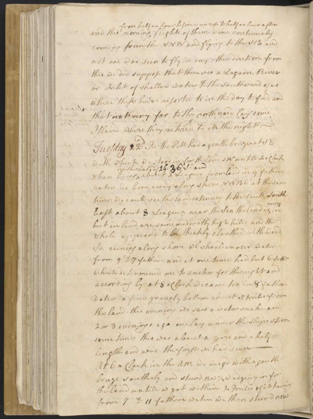
before to day we seldom saw more than 2 or 3 at a time and only when we was were near the land. last night a small flock of these birds pass'd the Ship and went away to the NW and this morning from half an hour before sun rise to half an hour after flights of them were continualy coming from the NNW and flying to the SSE and not one was seen to fly in any other dire[c]tion from this we did suppose that there was a Lagoon, River or Inlet of shallow water to the southward of us where these birds resorted to in the day to feed and that not very far to the northward lay some Island where they retired to in the night —
Sunday 20th Winds southerly gentle breezes, At 1 oClock in the PM we pass'd at the distance of 4 Miles having 17 fm water a black bluf head or point of land on which a number of the natives were assembled, which occasioned my nameing it Indian Head / Latde 25°0' / NBW.
4 Miles from this head the is a nother much like it, from this last the land trends a little more to the westward and low and sandy next the Sea, for what may be behind it we know not if land it must be all very low for we could see no part of it from the mast head.
We saw people in other places besides the one I have mentioned, some smooks in the day and fires in the night. Having but little wind all night we kept on to the northward — haveing from 17 to 34 fathom water from 4 Miles to 4 Leagues from the land. the northermost part of which bore from us at day light WSW and seem'd to End in a point from which we discover'd a reef stretching out to the northward as far as we could see, being at this time in 18 fathom water for we had before it was light hauld our wind to the westward and this course we continued untill we had plainly discoverd breakers a long way upon our lee bow which saweemd to stretch quite home to the land, we than edge'd away NW and NNW along the East side of the shoal from 2 to 1 Mile off having regular even soundings from 13 to 7 fathom a fine sandy bottom —
At Noon we were by observation in the Latitude of 24°..26' So which was 9 13 Miles to the northward of that given by the Log. the extreme point of the reef Shoal we judged to bear about NW from us and the point of land above mentioned bore S¾W distant 20 Miles, this point I have named Sandy Cape on accou[n]t of two very large white patches of Sand upon it, it is of a height sufficient to be seen 12 Leagues in clear weather / Latde 24°..46', Longde 206°.51' / from it the Land trended away WSW and SW as far as we could see —
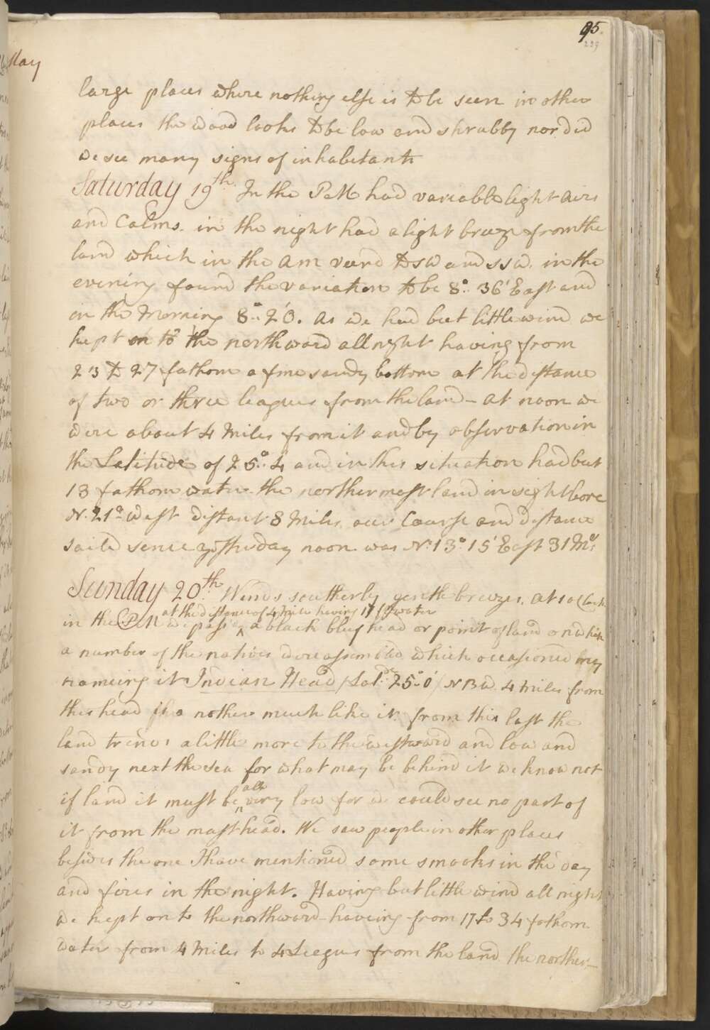
Saturday 19th In the PM had variable light Airs and Calms, in the night had a light breeze from the land which in the AM veerd to SW and SSW, in the evening found the variation to be 8°..36' East and in the Morning 8°..20'.
As we had but little wind we kept to on th to the northward all night having from 23 to 27 fathom a fine sandy bottom at the distance of two or three leagues from the land — At Noon we were about 4 Miles from it and by observation in the Latitude of 25°..4' and in this situation had but 13 fathom water — the northermost land in sight bore N 21° West distant 8 Miles, our Course and distance saild sence yesterday noon was No 13°.15' East 31 Ms
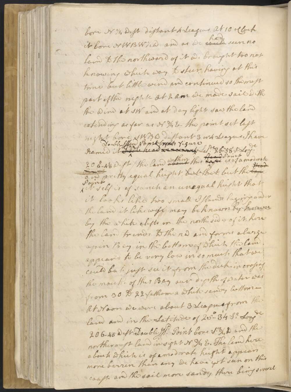
Friday 18th In steering along shore at the distance of two leagues off our soundings was from 24 to 32 fathom a sandy bottom. At 6 oClock PM the northern point of land set bore N¼ West distant 4 Leagues. At 10 oClock it bore NWBW½W and as we could had seen no land to the northward of it we brought too not knowing which way to steer, having at this time but little wind and continued so for the most part of the night —
At 2 AM we made sail with the wind at SW and at day light saw the land extending as far as N¾E — the point set last night bore SWBW distant 3 or 4 Leagues, I have named it Fiddle Head Double Island Point on account from its figure / Latde 25°..58' So Longde 206°..48' West / the land about within this cape Head Point is of a moderate Point and pretty equal height but that but the Cape Head Point it self is of such an unequal height that it looks like two small Islands laying under the land it likewise may be known by known by the white clifts on the north side of it, here the land trends to the NW and forms alarge opin bay in the bottom of which the land appear'd to be very low in so much that we could but just see it from the deck — in crosing the mouth of this Bay our depth of water was from 30 to 22 fathom a white sandy bottom —
At Noon we were about 3 Leagues from the land and in the Latitude of 25°..34' So Longde 206°..45 West. Double Isld Point bore So¾W and the northermost land in sight N¾E. The land here abouts which is of a moderate height appears more barren than any we have yet seen on this coast and the soil more sandy there being several large places where nothing else is to be seen in other places the wood looks to be low and shrubby, nor did we see many signs of inhabitants
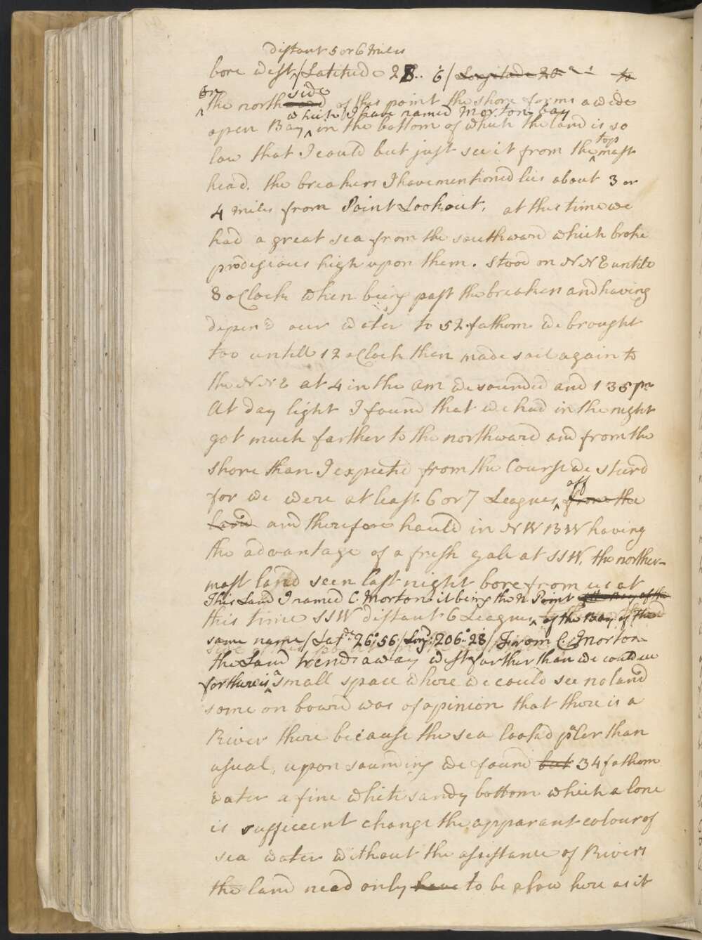
Thursday 17th Winds southerly mostly a fresh breeze with which in the PM we steer'd along shore N¾E at the distance of about 2 Leagues off. Between 4 and 5 we discoverd breakers on our larboord bow our depth of water at this time was 37 fathom — At sun set the northermost land in sight bore NBW, the breakers NWBW distant 4 Miles and the northermost land set at noon which form'd a point which I nam'd Point lookout bore west distant 5 or 6 Miles / Latitude 278°6' Longitude 20° ' to
On the northward side of this point the shore forms a wide open Bay which I have named Morton bay in the bottom of which the land is so low that I could but just see it from the top mast head. the breakers I have mentioned lies about 3 or 4 Miles from Point Lookout, at this time we had a great sea from the south ward which broke prodigious high upon them. Stood on NNE untill 8 oClock when being past the breakers and having depen'd our water to 52 fathom we brought too untill 12 oClock than made sail again to the NNE at 4 in the AM we sounded and 135 fm
At day light I found that we had in the night got much farther to the northward and from the shore than I expected from the Course we steerd for we were at least 6 or 7 Leagues off from the land and therefore haul'd in NWBW having the advantage of a Fresh Gale at SSW, the northermost land seen last night bore from us at this time SSW distant 6 Leagues This land I named C. Morton it being the N Point of the Bay of the Bay of the of the Bay of the the same name / Latde 26° 56' / Longd 206° 28' /
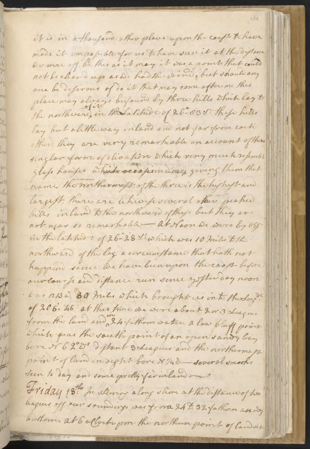
From C. Morton the Land trends away west farther than we could see for there is a small space where we could see no land some on board was of opinion that there is a River there because the Sea lookd paler than usual, upon sounding we found but 34 fathom water a fine white sandy bottom which a lone is sufficeint [to] change the apparant colour of sea water without the assistance of Rivers the land need only have to be a[s] low here as it is in a thousand other places upon the coast to have made it impossible for us to have seen it at the distance we were off. be this as it may it was a point that could not be clear'd up as we had the wind, but should any one be desirous of do[ing] it that may come after me this place may always be found by three hills which lay to the northward of it in the Latitude of 26°..53' So these hills lay but a little way inland and not far from each other, they are very remarkable on account of there singlar form of elivation which very much resemble glass houses which occasioned my giving them that name, the northermost of the three is the highest and largest, there are likewise several other peaked hills inland to the northward of these but they are not near so remarkable —
At Noon we were by Obsn in the Latitude of 26°..28' So which was 10 Miles to the northward of the log a circumstance that hath not hapend sence we have been upon the coast before our course and distance run sence yesterday noon was NBW, 80 Miles which brought us into the Longde of 206°..46 At this time we were about 2 or 3 Leagues from the land and in 24 fathom water — A low bluff point which was the south point of an open sandy bay bore N 62° Wt distant 3 Leagues and the northermost point of land in sight bore N¼E —
Several smooks Seen today and some pretty far inland —
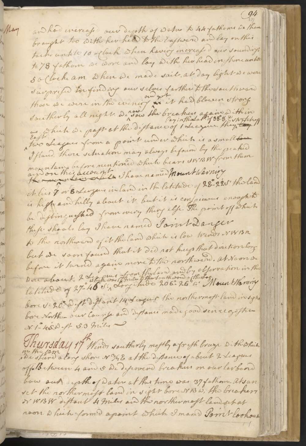
Wednesday 16th Winds southerly a fresh gale with which we steerd North along shore untill sun-set at which time we discoverd breakers ahead and on our larboard bow, being at this time in 20 fathom water and about 5 Miles from the land, hauld off east untill 8 oClock at which time we had run 8 Miles and had increased our depth of water to 44 fathoms we than brought too with her head to the Eastward and lay on this tack untill 10 o'Clock when having increased our soundings to 78 fathoms we wore and lay with her head in shore untill 5 oClock AM when we made sail,
At day light we were surprised by finding ourselves farther to the southward than we were in the evening and yet as it had blowen strong Southerly all night. We now saw the breakers again within us which we past at the distance of 1 League, they lay in the Latde of 38°..8' lay stretch off East two Leagues from a point under which is a small low Island, there situation may always be found by the peaked mountain before mentioned which bears SWBW from them this mountain or hill and on this account I have named Mount Warning it lies 7 or 8 Leagues inland in the latitude of 28°..22' So the land is high and hilly about it but it is conspicuous enough to be distinguished from everything else.
The point off which these shoals lay I have named Point Danger to the northward of it the land which is low trends NWBN but we soon found that it did not keep that direction long before it turnd again to the northward. At Noon we were about 2 Leagues from the land and by observation in the Latitude of 27°46' So which was 17 Miles to the Southward of the Log Longitude 206°..26' Wt Mount Warning bore So 20° West distant 14 Leagues, the northermost land in sight bore North — our Course and distance made good sence yester N. 1°..45' West 53 Miles —
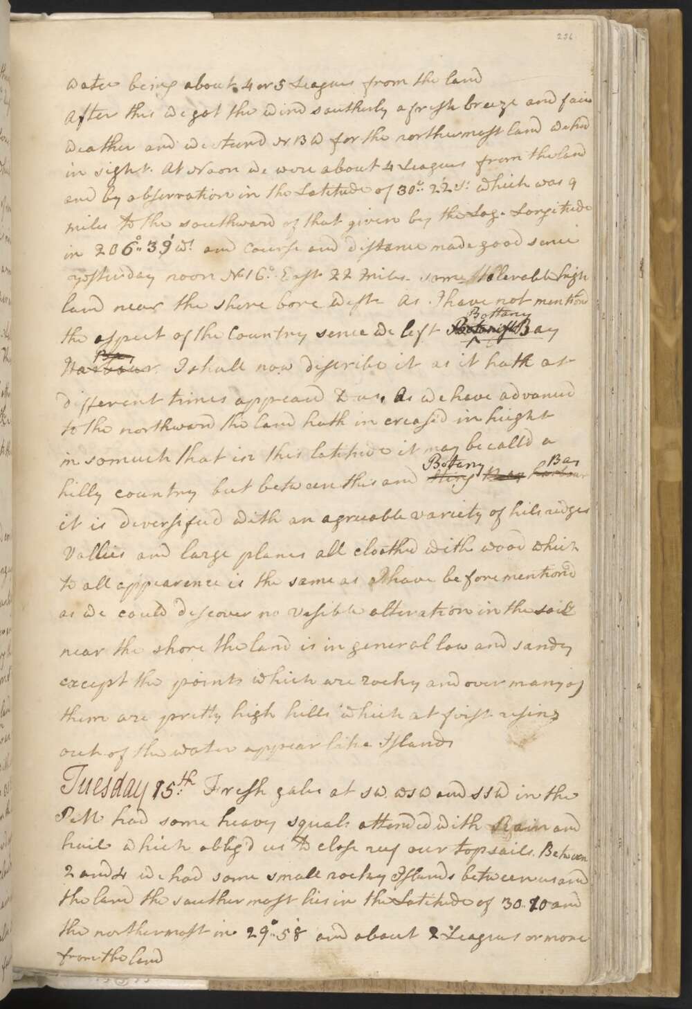
Tuesday 15th Fresh gales at SW, WSW and SSW in the PM had some heavy squals attended with Rain and hail which oblig'd us to close reef our Topsails. Between 2 and 4 we had some small rocky Islands between us and the land the southermost lies in the Latitude of 30°.. 2 10' and the northermost in 29°..58' and about 2 Leagues or more from the land
we sounded and had 33 fathom water about 2 Miles without this last Island. At 8 oClock we brought too untill 10 at which time we made sail under our topsails having the advantage of the Moon we steerd along shore North and. NBE keeping at the distance of about 3 Leagues from the land having from 30 to 25 fathom water, as soon as it was day light we made all the sail we could having the advantage of a fresh gale and fine weather.
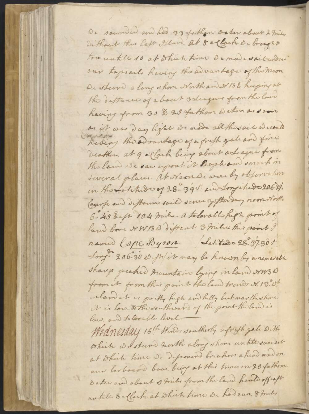
At 9 oClock being about a League from the land we saw upon it People and smook in several places. At Noon we were by observation in the Latitude of 28°..39' So and Longitude 206°..27'. Course and distance saild sence yesterday at noon North 6°..45' East 104 Miles —
A tolerable high point of land bore NWBW distant 3 Miles — this point I named Cape Byron / Latitude 28°..37'..30" So Longitude 206°..30' West / it may be known by a remar[k]able sharp peaked Mountain Iying inland NWBW from it. from this point the land trends N. 13° Wt inland it is pretty high and hilly but near the shore it is low — to the southward of the point the land is low and tolerable level —
Monday 14th At 1 PM it fell calm and continued so about an hour when a breeze sprung up at NE with which we stood in shore untill 6 oClock when being in 30 fathom water and 3 or 4 Miles from the land we tackd having the wind at NNW. at this time Smooky Cape bore So ¾ W distant about 5 Leags and the northermost land in sight N ¼ E.
At 8 oClock we made a trip in shore for an hour after this the wind came cross off shore with which we stood along shore to the northward having from 30 to 21 fm water at the distance of 4 or 5 Miles from the land, At 5 AM the wind veer'd to north and blow'd a fresh breeze attended with squals and dark clowdy weather
At 8 oClock it began to Thunder and rain which lasted about an hour and then fell calm which gave us an oppertunity to sound and found 86 fm water being about 4 or 5 Leagues from the Land
After this we got the wind southerly a fresh breeze and fair weather and we steerd NBW for the northermost land we had in sight. At Noon we were about 4 Leagues from the land and by observation in the Latitude of 30°..22' So which was 9 Miles to the southward of that given by the Log. Longitude in 206°..39' Wt and course and distance made good sence yesterday noon No 16° East 22 Miles — Some tolerable high land near the shore bore west —
As I have not mentiond the aspect of the Country sence we left Botanist Bottany Bay Harbour Bay I shall now discribe it as it hath at different times appeard to us. As we have advanced to the northward the land hath increased in height in so much that in this latitude it may be call'd a hilly country but between this and Sting Ray harbour Botany Bay it is diversified with an agreeable variety of hils ridges Vallies and large planes all cloathed with wood which to all appearence is the same as I have before mentiond as we could discover no Visible alteration in the soil near the shore the land is in general low and sandy except the points which are rocky and over many of them are pretty high hills which at first rising out of the water appear like Islands
Sunday 13th In the PM stood in shore with the wind at NE untill 6 oClock at which time we tack'd being about 3 or 4 Miles from the land and in 24 fathom water — Stood off shore with a fresh breeze at North and NNW untill Midnight at night then tackd being in 118 fathom water and 8 Leagues from the Land — At 3 AM the wind veer'd to the westward and we tack'd and stood to the northward —
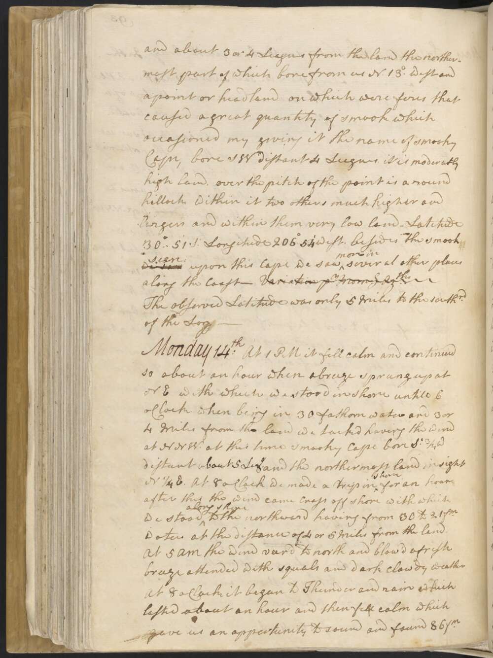
At Noon we were by observation in the Latitude of 30°..43' So and Longde 206°..45' west and about 3 or 4 Leagues from the Land the northermost part of which bore from us N. 13° West and a point or head land on which were fires that caused a great quantity of smook which occasioned my giving it the name of smooky Cape, bore SW distant 4 Leagues.
it is moderatly high land, over the pitch of the point is a round hillock within it two others much higher and largers and within them very low land — Latitude 30°..51' So Longitude 206° 54' West, besides the smook we saw seen upon this Cape we saw more in several places along the Coast — Variation pr Azths The observed Latitude was only 5 Miles to the southrd of the Log —
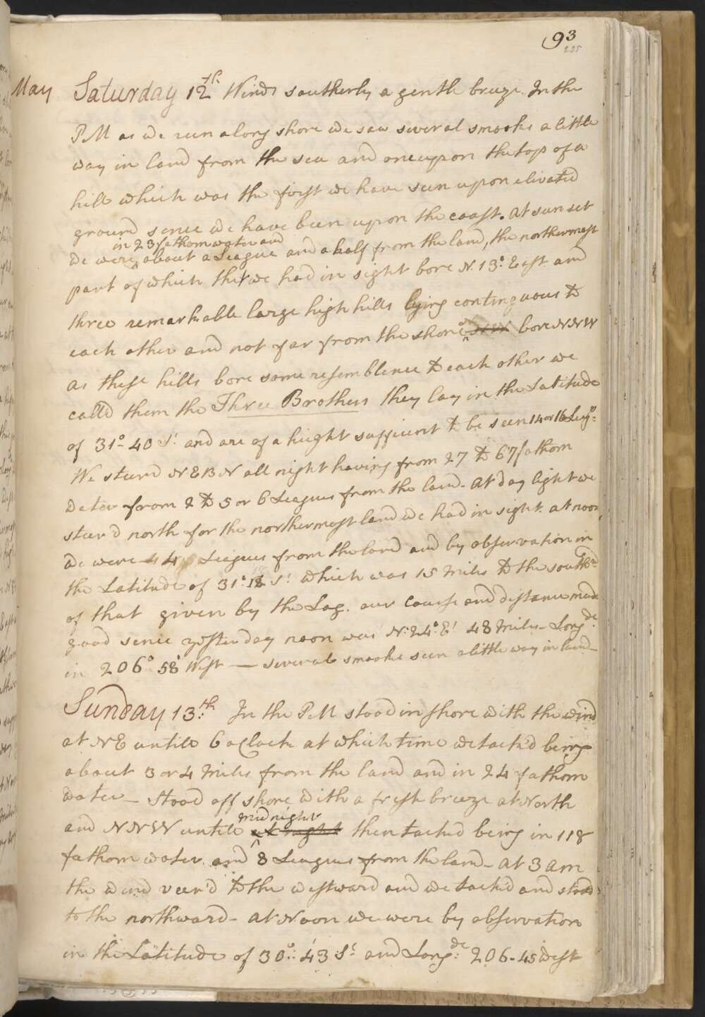
Saturday 12th Winds southerly a gentle breeze. In the PM as we run along shore we saw several smooks a little way in land from the Sea and one upon the top of a hill which was the first we have seen upon elivated ground sence we have been upon the coast.
At sun set we were in 23 fathom water and about a League and a half from the land, the northermost part of which we had in sight bore N 13° East and three remarkable large high hills lying continguous to each other and not far from the shore NW bore NNW As these hills bore some resemblence to each other we call'd them the Three Brothers they lay in the Latitude of 31°-40' So and are of a hieght sufficent to be seen 14 or 16 Leags
We steerd NEBN all night having from 27 to 67 fathom water from 2 to 5 or 6 Leagues from the land — At day light we steer'd north for the northermost land we had in sight.
at noon we were 4 Leagues from the Land and by observation in the Latitude of 31° 128' So which was 15 miles to the southrd of that given by the Log. our Course and distance made good sence yesterday noon was N 24° Et 48 Miles. Longde in 206° 58' West — Several smooks seen a little way in land —
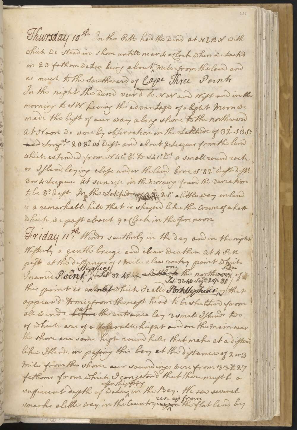
Friday 11th Winds southerly in the day and in the night Westerly a gentle breeze and clear weather. At 4 PM past at the distance of 1 Mile a low rocky point which I named Point Stephens / Latde 32° 45 a little to on the north ward side of this point is an inlet which I calld Port Stephens / Lat. 32° 40, Logde 207° 51' / that appear'd to me from the mast head to be shelterd from all winds, before at the entrance lay 3 small Islands two of which are of a tolerable height and on the Main near the shore are some high round hills that make at a distance like Islands, in passing this bay at the distance of 2 or 3 miles from the shore our soundings were from 33 to 27 fathoms from which I conjector'd that there must be a sufficient depth of water for shipping in the Bay.
We saw several smooks alittle way in the Country upon rise up from the flat land by this I did suppose that there were Lagoons which afforded subsistance for the natives such as shell fish &Ca for we as yet know nothing else they live upon
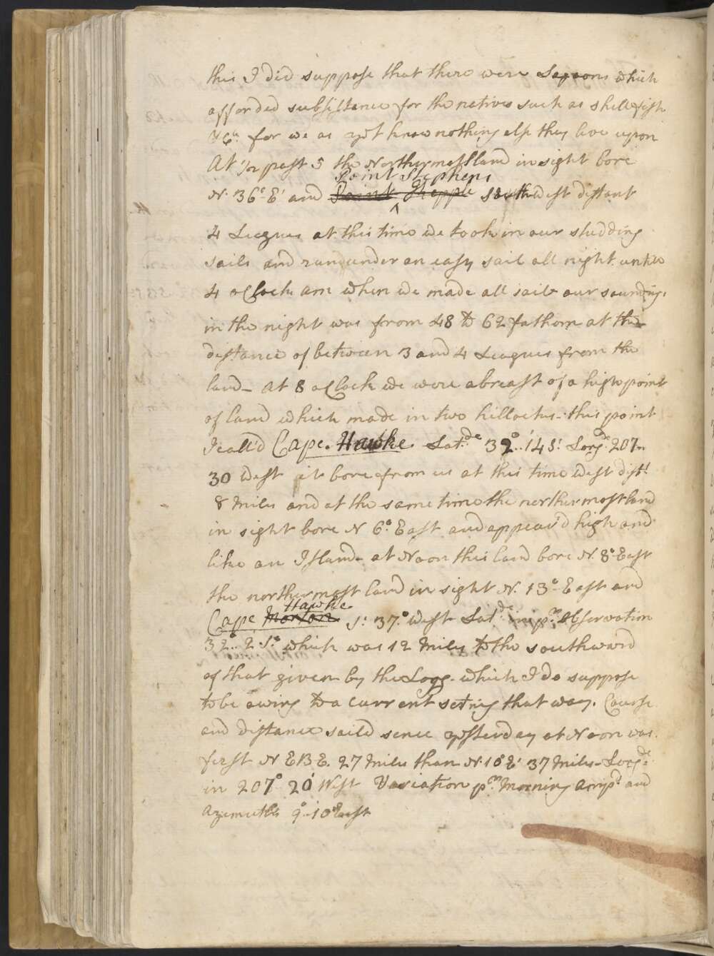
At ½ past 5 the Northermost land in sight bore N. 36° Et and Point Point Stephens Kepple South-west distant 4 Leagues at this time we took in our studding sails and run under an easey sail all night untill 4 oClock AM when we made all sail — our soundings in the night was from 48 to 62 fathom at the distance of between 3 and 4 Leagues from the land — At 8 oClock we were abreast of a high point of land which made in two hillocks — this point I called Cape Hawke Latde 32°..14' So Longde 207°..30 West; it bore from us at this time west distt 8 Miles and the same time the northermost land in sight bore N 6° East and appear'd high and like an Island —
at Noon this land bore N. 8° East the northermost land in sight N. 13° East and Cape Morton Hawke So 37° West — Latde in pr Observation 32°..2' So which was 12 Miles to the southward of that given by the Logg — which I do suppose to be owing to a current setting that way.
Course and distance saild sence yesterday at Noon was first NEBE. 27 Miles than N. 10° E 37 Miles — Longde in 207° 20' West Variation pr Morning Ampde and Azimuths 9°..10' East.
Thursday 10th In the PM had the wind at NEBN with which we stood in shore untill near 4 oClock when we tack'd in 23 fathom water being about a Mile from the land and as much to the Southward of Cape Three Points In the night the wind veer'd to NW and West and in the morning to SW. having the advantage of a light Moon we made the best of our way along shore to the northward
At Noon we were by observation in the Latitude of 32°..53' So Longde 208°..00' West and about 2 Leagues from the Land which extended from N 41°. Et to S 41°. Wt A small round rock or Island laying close under the land bore So 82° West distt 3 or 4 Leagues.
At sun rise in the Morning found the variation to be 8° East. In the Latitude of 33°..2' So a little way inland is a remarkable hill that is shaped like the Crown of a hatt which we past about 9 oClock in the forenoon
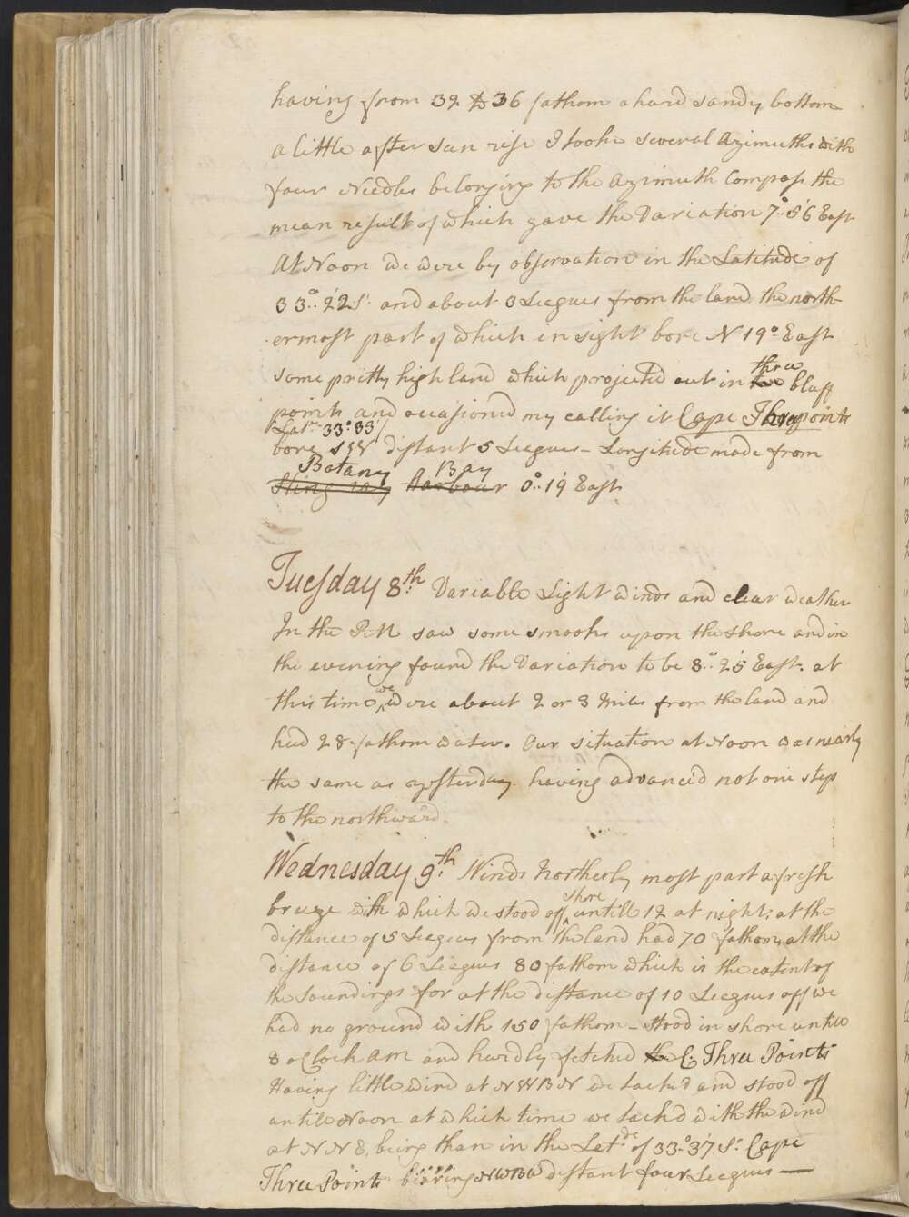
Wednesday 9th Winds Northerly most part a fresh breeze with which we stood off shore untill 12 at night, at the distance of 5 Leagues from the land had 70 fathom, at the distance of 6 Leagues 80 fathom which is the extent of the Soundings for at the distance of 10 Leagues off we had no ground with 150 fathom —
Stood in shore untill 8 oClock AM and hardly fetched the C. Three Points — Having little wind at NWBN we tack'd and stood off untill Noon at which time we tackd with the wind at NNE, being than in the Latde of 33°..37' So Cape Three Points bearing NWBW distant four Leagues —
Tuesday 8th Variable Light winds and clear weather In the PM saw some smooks upon the shore and in the evening found the Variation to be 8°..25' East. at this time we were about 2 or 3 Miles from the land and had 28 fathom water.
Our situation at Noon was nearly the same as yesterday. having advance'd not one step to the northward.
Monday 7th Little wind southerly and serene pleasent weather. In the PM found the Variation by Several Azimuths to be 8° East — At sun set the Northermost land in sight bore N. 26° East, and some broken land that appear'd to form a Bay boare N. 40° West distant 4 Leagues. this Bay I named Broken Bay Latitude 33°..36' So We steerd along shore NNE all night at the distance of about 3 Leagues from the land having from 32 to 36 fathom a hard sandy bottom
A little after Sun rise I tooke several Azimuths with four Needles belonging to the Azimuth Compass the mean result of which gave the Variation of 7°..56' East
At Noon we were by observation in the Latitude of 33°..22' So and about 3 Leagues from the land, the northermost part of which in sight bore N 19° East Some pritty high land which projected out in two three bluff points and occasioned my calling it Cape Three Points / Latde 33° 33' / bore SW distant 5 Leagues — Longitude made from Sting ray Harbour Botany Bay 0°..19' East
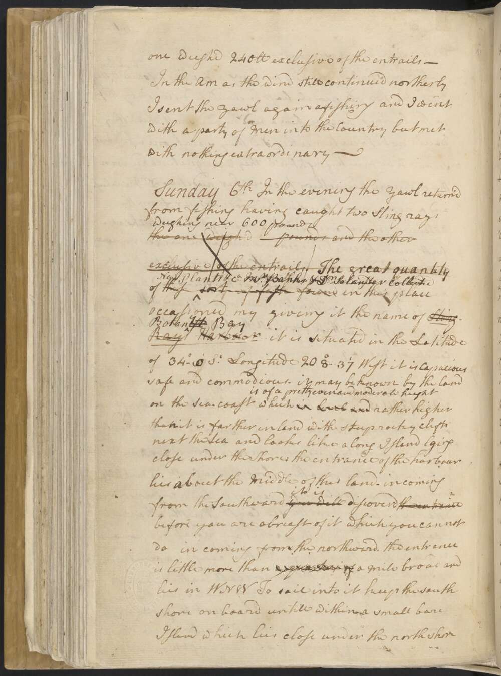
Sunday 6th In the evening the yawl return'd from fishing having caught two Sting rays weighing near 600 pounds the one weigh'd pounds and the other exclusive of the entrails.
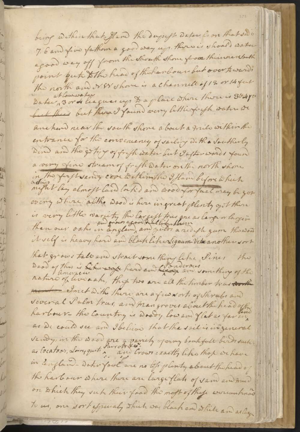
The great quantity of New Plants &Ca Mr Banks & Dr Solander collected of this sort of fish found in this place occasioned my giveing it the name of Sting-Ray Harbour Botanyist Bay it is situated in the Latitude of 34°..0' So Longitude 208°..37' West it is Capacious safe and commodious — it may be known by the land on the Sea-coast which is of a pretty even and moderate height is level and rather higher than it is farther inland with steep rocky clifts next the Sea and looks like a long Island lying close under the Shore: the entrance of the harbour lies about the Middle of this land — in coming from the Southward you will it is discover'd the entrance before you are abreast of it which you cannot do in coming from the northward. the entrance is little more than a quarter of Mile broad and lies in WNW.
To sail into it keep the south shore on board untill within a small bare Island which lies close under the north shore being within that Island the deepest water is on that side 7, 6 and five fathom a good way up.
there is shoal'd water a good way off from the South Shore from the inner South point qu[i]te to the head of the harbour but over to wards the north and NW shore is a channell of 12 or 14 feet water at low water 3 or 4 leagues up to a place where there is 3 & 4 fm but there but here I found very little fresh water we anchord near the south shore about a Mile within the entrance for the conveniency of sailing with a Southerly wind and the geting of fresh water but I afterwards found a very fine stream of fresh water on the north shore in the first sandy cove within the Island before which a Ship might lay almost land lock'd and wood for fual may be got every where: altho wood is here in great plenty yet there is very little variety the largest trees are as large or larger than our oaks in England and grows a good deal like them and yeilds a redish gum the wood itself is heavy, hard and black like Lignum Vitae
another sort that grows tall and strait some thing like Pines the wood of this is like wise hard and heavy Ponderous and something of the nature of American live oak, these two are all the timber trees worth mentioning I met with, there are a few sorts of Shrubs and several Palm trees, and Mangroves about the head of the harbour —
the Country is woody low and flat as far inland as we could see and I believe that the soil is in general sandy, in the wood are a variety of very boutifull birds such as Cocatoo's, Lorry quets Parrots &Ca and Crows exactly like those we have in England — Water fowl are no less plenty about the head of the harbour where there are large flats of sand and Mud on which they seek their food. the most of these were unknown to us, one sort especialy which was black and white and as large as a goose but most like a pelican.
On the Sand and Mud banks are Oysters, Muscles, Cockles &Ca which I beleive are the cheif support of the inhabitants who go into shoald water with their little canoes and pick them out of the sand and Mud with their hands and sometimes roast and eat them in the Canoe, having often a fire for that purpose as I suppose for I know no other it can be for.
The Natives do not appear to be numerous neither do they seem to live in large bodies but dispers'd in small parties along by the water side. they are those I saw were about as tall as Europeans of a very dark brown colour but not black nor had they wooly frizled hair, but black and lank much like ours — no sort of cloathing or ornaments was were ever seen by any of us upon any one of them or in or about any of their hutts from which I conclude that they never wear any —
some that we saw had their faces and bodies painted with a sort of white paint or Pigment something that look'd white . Altho I have said that shell fish is their chief support yet they catch other sorts of fish, some of which we found roasting on the fire the first time we landed, some of these they strike with gigs and others they catch with hook and line we have seen them strike fish with gigs & hooks and lines were found in their hutts —
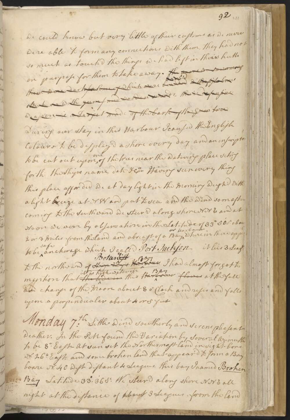
Sting rays I believe they do not eat because I never saw the least remains of one near any of their hutts or fire places, neither were any of their darts or offensive weapons arm'd with the Stings of Sting rays the use I think they would apply'd them to did they make use of the fish. none of us ever saw any provisions laid up in store so that I beleive that they depend upon the present day for their subsistence, h However we could know but very little of their customs as we never were able to form any connections with them, they had not so much as touch'd the things we had left in their hutts on purpose for them to take away. The one we saw among them were darts / as some of which were bounded barb'd with fish bones stuck on with gum / and wooden swords — their defensive weapon is a Target made of the bark of the Gum tree
During our stay in this Harbour I caused the English Colours to be display'd a shore every day and an inscription to be cut out upon one of the trees near the watering place seting forth the Ships name, date &Ca —
Having seen every thing this place afforded we at daylight in the Morning weigh'd with a light breeze at NW and put to sea and the wind soon after coming to the Southward we steer'd along shore NNE and at Noon we were by observation in the Latitude of 33°.50' So about 2 or 3 Miles from the land and abreast of a Bay or Harbour wherein there apperd to be safe anchorage which I call'd Port Jackson. it lies 3 leags to the northward of Sting Ray's Harbour Botanyist Bay, I had almost forgot to mention that the tide in it is high water in this Harbour Bay flowes at the full and change of the Moon about 8 o'Clock and rises and falls upon a perpendicular about 4 or 5 feet
Saturday 5th In the PM I went with a party of Men over to the North shore and while some hands were hauling the Saine a party of us made an excursion of 3 or 4 Miles into the Country or rather along the Sea Coast. we met with nothing remarkable. great part of the Country for some distance in land from the sea Coast is mostly a barren heath diversified with marshes and Morasses —
Upon our return to the Boat we found they had caught a great number of small fish which the sailors call Leather Jackets on account of their having a very thick skin. they are known in the West Indias.
I had sent the yawl in the morning to fish for Sting rays who return'd in the evening with upwards of 4 hundred weight — one single one weigh'd 240 Ib exclusive of the entrails —
In the AM as the wind still continued northerly I sent the yawl again afishing and I went with a party of Men into the Country but met with nothing extraordinary —
Friday 4th — Winds Northerly serene weather Upon my return to the Ship in the evening I found that none of the natives had appear'd near the watering place but about 20 Canoes of them had been fishing in their Canoes at no great distance from us. In the AM as the wind would not permit us to sail I sent out some parties into the Country to try to form some Connections with the natives.
one of the Midshipmen met with a very old man and woman and two small Children they were close to the water side where several more were in their canoes gathering shell fish and he being alone was afraid to make any stay with the two old people least he should be discoverd by those in the Canoes — he gave them a bird he had shott which they would not touch neither did they speak one word but seem'd to be much frightn'd, they were quite naked even the woman had nothing to cover her nuditie.
Dr Munkhouse and a nother man being in the woods not far from the watering place discoverd Six more of the natives who at first seem'd to wait his coming but as he was going upon to them he had a dart thrown at him out of a tree which narrowly escaped him, as soon as the fellow had thrown the dart he desended the tree and made off and with him all the rest and these were all that were met with in the Course of this day
Thursday 3rd Winds at SE a gentle breeze and fair weather. In the PM I made a little excursion along the Sea Coast to the southward accompaned by Mr Banks and Dr Solander. At our first entering the woods we saw 3 of the natives who made off as soon as they saw us — more of them were seen by others of our people but who likewise made off as soon as they found they were discover'd.
In the AM I went in the Pinnace to the head of the Bay accompan'd by Drs Soland and Munkhouse in order to examine the Country and to try to form some Connections with the natives: in our way thither we met with 10 or 12 of them fishing each in a Small Canoe who retired in to shoald water upon our approach, others again we saw at the first place we landed at who took to their Canoes and fled before we came near them: after this we took water and went almost to the head of the inlet where we landed and travel'd some distance inland.
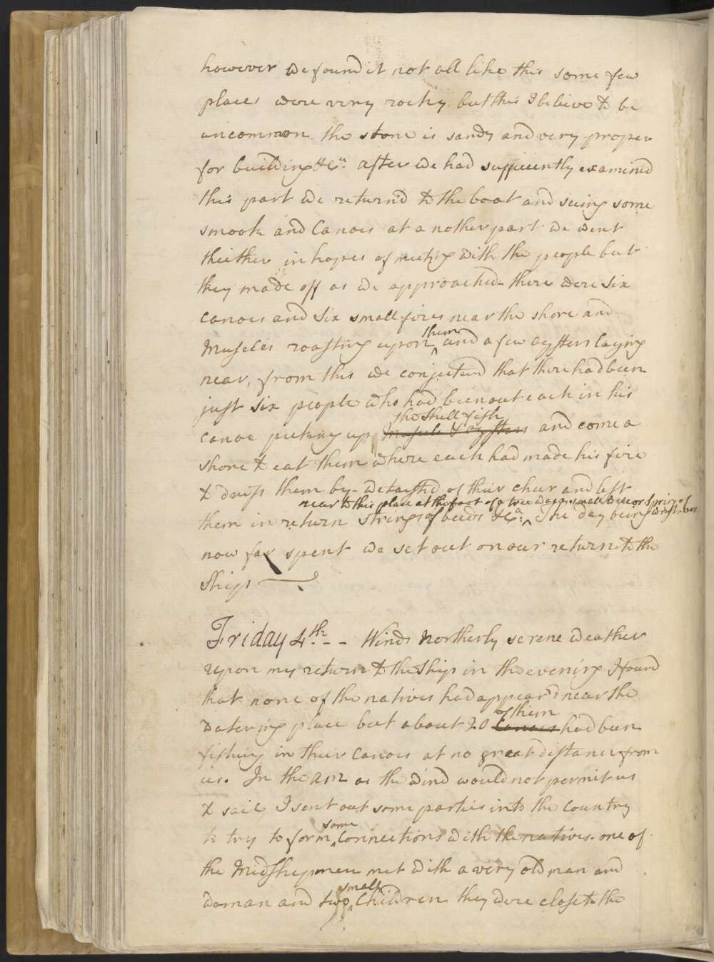
We found the face of the Country much the same as I have before described but the soil land much richer being for instead of sand I found in many places a deep black Soil which we thought was capable of produceing any kind of grain at present it produceth besides timber as fine meadow as ever was seen However we found it not all like this some few places were very rocky but this I beleive to be uncommon.
the stone is sandy and very proper for building &Ca After we had sufficiently examined this part we return'd to the boat and seeing some smook and Canoes at a nother part we went theither in hopes of meeting with the people but they made off as we approached — there were Six Canoes and Six small fires near the shore and Muscles roasting upon thim and a few Oysters laying near, from this we conjecturd that there had been just Six people who had been out each in his Canoe picking up Muscles & oysters the Shell fish and come a shore to eat them where each had made his fire to dress them by — we taisted of their cheer and left them in return Strings of beeds &Ca near to this place at the foot of a tree was a small well or Spring of w[ate]r The day being now far spent we set out on our return to the Ship —
Wednesday 2d Between 3 and 4 oClock in the PM we returnd out of the Country and after dinner went a shore to the watering place where we had not been long before 17 or 18 of the natives appear'd in sight, in the morning I had sent Mr Gore with a boat up to the head of the bay to dridge for oysters in his return to the ship he and a nother person came by land and met with these people who follow'd him at the distance of 10 or 20 yards when ever Mr Gore made a Stand and face'd them they s[t]ood also and not withstanding they were all arm'd they never offerd to attack him but after he had parted from them and they were met by Dr Munkhouse and one or two more who upon makeing a sham retreat they throw'd 3 darts after them, after which the[y] began to retire
Dr Solander, I, and Tupia made all the haste we could after them but could by neither words nor actions prevail upon them to come near us. Mr Gore saw some up the bay who by signs invited him a shore which he prudantly declined —
In the AM had the wind at SE with rain which prevented me from makeing an excursion up the head of the bay as I intended
Tuesday, May 1st Gentle breezes northerly. In the PM ten of the Natives again Viseted the watering place. I being on board at this time went emmediatly aShore, but before I got there they were going away, I follow'd them alone and unarm'd some distance along shore but they would not stop untill they got farther off than I thought choose to trust myself these were arm'd in the same manner as those that came yesterday.
In the evening I sent some hands to haul the Saine but they caught but a very few fish. A little after sun rise I found the Variation to be 11°..3' East.
Last night Torby Sutherland seaman departed this life and in the AM his body was buried a shore at the watering place which occasioned my calling the south point of this Bay after his name.
This morning a party of us went aShore to some hutts not far from the watering place where some of the natives are daily seen, here we left several articles such as Cloth, Looking glasses, Combs, Beeds, Nails &Ca after this we made an excursion into the country which we found deversified with woods, Lawns and Marshes; the woods are free from under wood of every kind and the trees are at such a distance from one a nother that the whole Country or at least great part of it might be cultivated without being oblig'd to cut down a single tree, we found the soil every where except in the Marshes to be a light white sand and produceth a quanty of good grass which grows in little tufts about as big as one can hold in ones hand and pretty close to one another, in this manner the surface of the ground is coated in the woods between the trees.
Dr Solander had a bad sight of a small Animal some thing like a rabbit and we found the dung of an Animal which must feed upon grass and which we judge could not be less than a deer we also saw the track of a dog or some such like Animal.
we met with some hutts or and places where the natives had been and at our first seting out one of them was seen the others I suppose had fled upon our approach. I saw some trees that had been cut down by the natives with some sort of a blunt instrument and several trees that were barked the bark of which had been cut by the same Instrument, in many of the trees, especialy the palms, were cut steps about 3 or 4 feet asunder for the conveniency of Climeing them — We found 2 sorts of Gum one sort of which is like Gum Dragon and is the same as what I suppose Tasman took for Gum lac and it is extracted from the largest tree in the woods.
Explore more of Cook's Journal